The Rongai Route is the only trail that starts from the Northern, or Kenyan side of Mt. Kilimanjaro.
Because of its remote location the route offers trekkers a relatively unspoilt wilderness experience where it is possible to see large wildlife like antelope, elephant and buffalo.
The North-East side of the mountain gets significantly less moisture than the southern slopes which means that trekkers are less likely to encounter rain. Trekkers are also more likely to get clear, unclouded views of the mountain.
Here's our complete guide to the Rongai route.
Plan your Kilimanjaro trek
Get a quote from our recommended local Kilimanjaro operator
Why Choose Rongai Route Kilimanjaro?
Rongai, The Best Route For Rainy Season On Kilimanjaro
As mentioned, the Rongai route is on the North side of Mt. Kilimanjaro, close to the Kenyan Border. During the rainy season (April -May) most of the rain falls on the southern side of the mountain. This means that Rongai is the only route that stays dry year round.
If your annual leave or vacation is restricted to April or May, The Rongai route is the best choice to climb Kilimanjaro.
The Least Crowded Route On Kilimanjaro
Rongai route is one of the least busy of all the Kilimanjaro trails. This makes it the perfect choice for those who want to dodge the crowds and enjoy time on the mountain almost all to themselves (this is even more true if your hiking over rainy season!).
It is not uncommon to see very few or even no other groups on the trail on the first few days. At Kibo camp (Day 5), the route merges with the Marangu route at which point there are more people around. Even so, Kilimanjaro Rongai route is perfect if you want a more off-the-beaten track experience.
High Summit Success Rate
The trek has a relatively gentle profile with similar trekking distances between the camps. This means gradual hike to the summit which gives you plenty of time to acclimatise. The last day before the summit push is also short which means hikers have a good chance to rest before climbing to Uhruru peak.
Because of its slow and steady profile, many trekkers ang guides consider Rongai to be one of the easiest routes up Kilimanjaro. The route has an impressively high summit success rate averaging around 80%- 90% on the 7-Day Route.
Rongai Route Map
The Rongai Route is flatter than the other Kilimanjaro routes but because of its profile it does not offer trekkers good options to climb high and sleep low.
It can be hiked on a six, seven or even eight day route. The seven or eight day Rongai Routes are highly recommended as trekkers have extra days to acclimatise.
Summit night from Kibo Hut is steep and follows the same path taken by Marangu trekkers which passes Gilman’s Point to Uhuru Peak.
Due to its remote setting the Rongai Route receives the least traffic of all the routes on Kilimanjaro.
The Rongai Route descends via the Marangu trail.
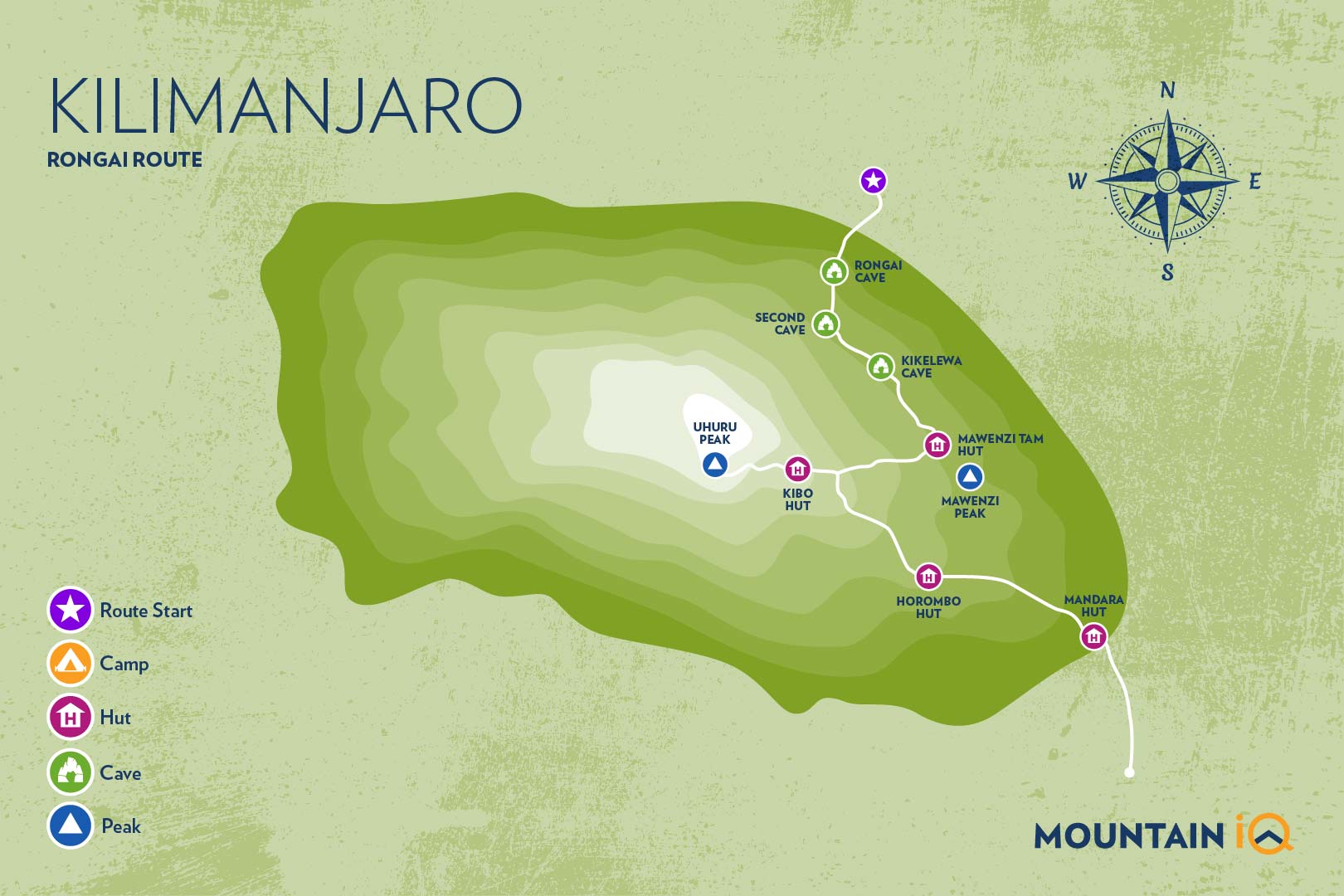
Rongai Route Itinerary
The itinerary below is for a 7-day Rongai Route trek. Six day trekkers do not spend an additional day at Mawenzi Tarn (4,300 meters) to acclimatise. Eight day trekkers also stop on day two at Rongai Second Cave (3,450 meters) before proceeding to Kikelewa Camp (3,600 meters).
Day 1 – Rongai Start Point (1,950 meters) to Rongai First Cave (2,620 meters)
Distance: ~8km / 5 miles
Trekking time: 4 hours
Zone: Rainforest
On day one Rongai Route trekkers are driven from either Moshi or Arusha to Marangu Gate for registration before being shuttled a further 70 kilometres on poor roads to the Rongai Start Point at 1,950 meters.
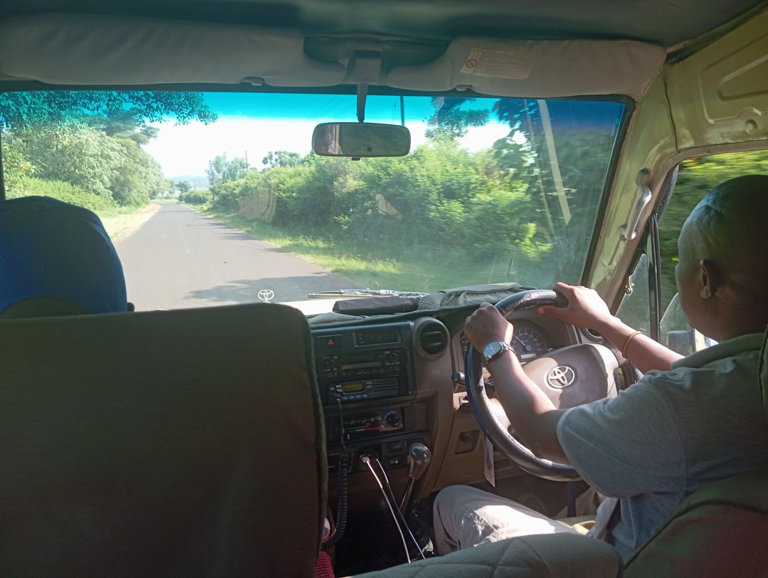
Most trekking companies use Land Cruisers, the standard safari vehicle in Tanzania, to navigate the often tricky roads to the entrance gate.
The trek begins from Nale Moru village and follows a gradual and winding trail that first crosses maize fields before entering the rainforest.
The first day’s hiking is easy going and you will arrive at Rongai First Cave (2,620 meters) around mid-afternoon, where you can freshen up and have dinner.
Day 2 – Rongai Cave (2,620 meters) to Kikelewa Camp (3,600 meters)
Distance: ~9km / 7 miles
Trekking time: 6-7 hours
Zone: Rainforest / Low-alpine zone
On day two the hike continues from Rongai First Cave through the rainforest before transitioning into the low alpine moorland zone where you will notice the vegetation change to shrubs and grasses.
You will stop for lunch at Rongai Second Cave (3,450 meters), 6km from the First Cave Camp, before turning east to Kikelewa Camp (3,600 meters) for your overnight stay.
Depending on your tour operator, eight day trekkers might stop at Rongai Second Caves for the night before proceeding to Kikelewa Camp.
Day 3 – Kikelewa Camp (3,600 meters) to Mawenzi Tarn (4,300 meters)
Distance: 6km / 4.5 miles
Trekking time: 4-5 hours
Zone: Low-alpine zone / High-alpine zone
Day three on the Rongai Route is a short, but steep climb from Kikelewa Camp to Mawenzi Tarn (4,300 meters) which sits in the shadow of the magnificent Mawenzi Peak.
You will arrive at Mawenzi Tarn in time for lunch and then have the whole afternoon to explore the surrounding area and acclimatise.
Plan your Kilimanjaro trek
Get a quote from our recommended local Kilimanjaro operator
Day 4 – Acclimatisation day at Mawenzi Tarn (4,300 meters)
Distance: 0 km
Trekking time: 0 hours
Zone: High-alpine zone
This day is important for acclimatisation. Your tour company may organise some short hiking excursions to explore the area.
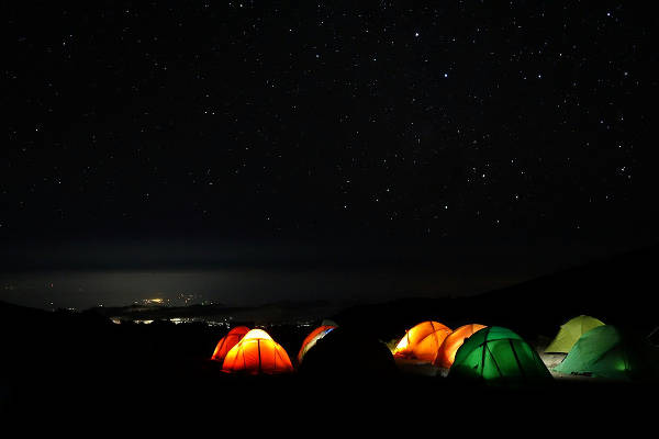
Use the day off to get some awesome pictures. Here's an epic shot by Christian Hennig showing night time on Kilimanjaro
Day 5 – Mawenzi Tarn (4,300 meters) to Kibo Hut (4,700 meters)
Distance: 9 km / 5.5 miles
Trekking time: 6-7 hours
Zone: High-alpine zone
Day five is a long but gradual hike from Mawenzi Tarn heading west through the Saddle which is formed between the peaks of Kibo and Mawenzi, and up to Kibo Hut (4,700 meters). The route is dry, barren and rather inhospitable, but provides spectacular views of Kibo.
At Kibo Hut you will get served dinner and will go to bed early as you will be awoken around 23:30 to begin your summit attempt. Trekkers should remember to prepare their gear, including headlamp, camera, insulated water and warm weather clothes before they go to sleep.
Day 6 – Kibo Hut (4,700 meters) to Uhuru Peak (5,895 meters) and then Horombo Hut (3,720 meters)
Distance: ~5.5km / 3 miles ascent and then 15km / 8 mile descent
Trekking time: 6-8 hours to the summit and then 5-8 hours to Horombo Hut
Zone: Glacial zone and the all preceding zones
Day six begins at midnight, after being awoken with tea and biscuits you will begin your ascent in the dark across a rocky path to the first check point, Hans Meyer Cave at 5,150 meters. You should have a break here and refuel on an energy bar.
The path then zigzags and increases in steepness as you approach Gilman’s Point 2-3 hours later at 5,681 meters. You are now on Kibo’s crater rim, a huge achievement! But you still have a 200 meter ascent to trek to the summit, Uhuru Peak (5,895 meters).
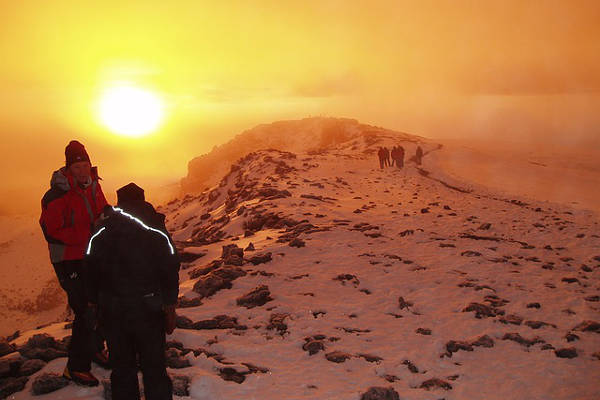
Sunrise, with the summit in the distance. Not far to go now!
Dig deep to find the reserves and mental stamina to push yourself up the final slopes. At Uhuru Peak you will be able to stay briefly before descending back to Kibo Hut and on to Horombo Hut. In total you will be trekking upwards of 12-16 hours. It will be one of the longest days of your life but well worth it! Here’s the good news, beers can be bought at Horombo Hut!
Day 7 – Horombo Hut (3,720 meters) to Marangu Gate (1,870 meters)
Distance: ~20km / 13 miles
Trekking time: 5-7 hours
Zone: Rainforest
The final day from Horombo Hut to Marangu Gate (1,870 meters) is a long one, nearly 20km! Your knees will be sore from the previous days hike so go slowly and make sure of your footing as you descend, using your trekking poles to limit the impact on your joints.
At Marangu Gate, the place where you signed in 6 days ago, you will now sign-out. Those who got as far as Gilman’s Point but no further will be presented with a green certificate. Trekkers who made it all the way to Uhuru Peak will receive a gold certificate.
Most trekkers present their porters and guides with their hard earned tips at this stage (see: tipping Kilimanjaro porters) before being driven back to your hotel for a well-deserved hot shower!
Plan your Kilimanjaro trek
Get a quote from our recommended local Kilimanjaro operator
Kilimanjaro Rongai Route Altitude Profile
Here's what the Kilimanjaro Rongai route altitude profile looks like.

Other Kilimanjaro routes and helpful guides:

Hi! We’re considering a 7-day trek via the Rongai route, which gives us an extra day for acclimatisation. We currently have two options regarding how to spend the extra day:
1) Repeat day 4 (Mawenzi Tarn – Kibo Hut), as you suggested for 7-day trekkers. For this option, we clearly have to do spend more time and energy on the hike as the total distance is longer. We’re also unsure if ascending for ~1000 metres on day 2 (First Cave – Kikelewa Camp) is too much.
2) Split day 2 into two halves at a camp at about 3200 metres. This way, we’ll ascend about 500 metres every day. However I guess we won’t acclimatise as well as option 1 due to less time at a higher altitude.
What’s your thought on these two options? Is option 1 clearly better than option 2?
Hi Charles, I’m a bigger fan of option 1. The big ascent on day two is a challenge but worth the effort and has acclimitisation benefits will pay dividends later on in the trek. Hope this helps!
Hi there, a friend of mine and I would like to climb Mount Kilimanjaro this year. We’re both pretty fit but have never done anything like this before. We’re considering either the Lemosho or Rongai Route – looking for best scenery and best chance of reaching the summit but also dont want it to be too busy. Recommendations would be greatly appreciated!
Hi Francesca, I’m a bigger fan of the Lemosho route than the Rongai. The Lemosho has better scenery through the rainforest jungle and up and over the Shira plateau than the Rongai, which is drier and flatter for the first few days. The Lemosho also has a better acclimatisation profile, with more opportunities to walk high and sleep low. Finally I think the summit push via Stella point is easier than the approach used on the Rongai via Gilmans Point. Hope this helps you make an informed decision on routes.
My wife and I are considering a trek up Kilimanjaro. We’re both about 70 years old. we have no climbing experience. In moderately good health. (1) Are we crazy? (2) If we can’t make it, is there a horse or something to ride up:))) (3) We will be riding our m/c from South Africa in Jan ’19. What is the best route? thanks, fred
Hi Fred, great to hear from you. In terms of your questions. 1. No, you not crazy. Many people in their 70s have climbed Kilimanjaro. Granted it is a very serious challenge, so you want to make sure you are fit and in good health. 2. Haha, unfortunately not. 3. Not sure if you are asking what is the best route to drive from SA to Tanzania, or what is the best route up Kilimanjaro. I’m not qualified to answer the former, but in terms of the latter, I’m a fan of the 8 day Lemosho or the 7 day Machame route. Hope this helps!
Hi, how is the cell phone coverage on the Rongainroute and what provider works best? Would you suggest a Satellite phone? Thanks
Hi Garen, cell phone coverage on all routes on Kilimanjaro is relatively good. A satellite phone is not required.
mark I am considering a 9 day rongai route or 11 day lemosho route trek to the top of Kilimanjaro the end of july 2019 are these good acclimatization treks and is this a good time of year to go ? this trip is a build up to Aconcagua in January 2020. I have been to Everest base camp and to the top of kala pattar and just did the tour mont blac circuit and several Colorado 14teeners.
Hi Rennie, great to hear you plan to climb Kilimanjaro in preparation for Aconcagua! Both the 7 day Rongai and 8 or 9 day Lemosho are great routes for acclimatisation. If I was pushed to choose one I would go for the 8 day Lemosho as it has a really quiet and wild start, the scenery is awesome and I prefer the summit passage from the Southern side of Kilimanjaro. All the best!
Hi, I was planning on climbing beginning of May, but I can't find any company that offers that time because of the raining season. Is it even possible to book it and do it during that time?
Hi Priscilla, yes, it is indeed the rainy season in May. There are companies that offer treks during this time but they will be private expeditions. To get a quote from my recommended partner go here: https://www.climbkilimanjaroguide.com/go/