The Northern Circuit is the newest and longest route on Mount Kilimanjaro.
It begins in the West at the Londorossi Gate and follows the same path as the Lemosho Route for the first two days.
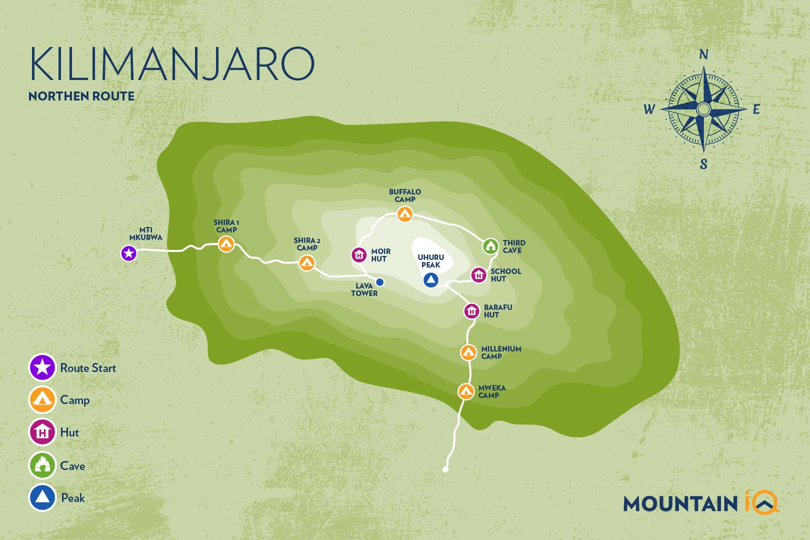
After crossing the Shira Plateau the path veers north near Lava Tower, following the longer Northern Circuit instead of the more popular Southern Circuit via Barranco Valley (see my map below).
The route circles around the quieter northern slopes to the east side of the mountain.
There are a few different Kilimanjaro route variations from this point; however, all approach the summit via Gilman’s Point and then either descend via the Mweka Route joining trekkers from the Machame, Umbwe, Lemosho and Shira routes, or via the Marangu Route.
Here's my complete guide to Kilimanjaro's Northern Circuit.
My Quick Takeaways:
Thinking about the Northern Circuit Route for Kilimanjaro? Here’s why it’s a top choice:
- Longest Route = Best Acclimatisation: With 8–9 days on the mountain, this route gives you the highest chance of reaching the summit.
- Less Crowded & More Scenic: Unlike busier routes, the Northern Circuit offers solitude and breathtaking 360° views of Kilimanjaro’s diverse landscapes.
- Gradual Ascent, Lower Altitude Sickness Risk: The route’s gentle climb improves your body’s adjustment to altitude, making it one of the safest options.
- A True Wilderness Experience: You’ll trek through remote, untouched areas of the mountain that most climbers never see.
- Higher Cost, But Worth It: This is one of the more expensive routes due to its length, but the experience and success rate make it a solid investment.
If you want the best acclimatisation, stunning scenery, and a quieter climb, the Northern Circuit is hard to beat. Ready to take the long way up? Let’s learn more about this epic Kilimanjaro route!
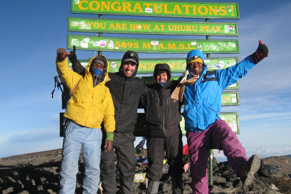
Plan your Kilimanjaro trek
Get a quote from my recommended local Kilimanjaro operator
Northern Circuit Route Map
The Northern Circuit is longer than the other trails on Kilimanjaro, taking a minimum of eight days to complete, with most tour operators offering a nine day trek.
The additional time on the mountain means that success rates for Northern Circuit trekkers are relatively high.
The eight day trek skips the additional acclimatization day that is usually spent at Shira Camp 2 and continues straight on to Moir Camp, via Lava Tower.
Kilimanjaro Northern Circuit Itinerary
The itinerary below is for a nine-day Northern Circuit trek, using the Mweka Route for descent.

Plan your Kilimanjaro trek
Get a quote from my recommended local Kilimanjaro operator
Day 1 – Londorossi Gate (2,100 meters) – start point 2,360 meters to Mti Mkubwa Camp (2,820 meters)
Distance: ~5.5km / 3.5 miles
Trekking time: 3-4 hours
Zone: Rainforest
The Northern Circuit Route begins at Londorossi Gate (2,100 meters) in the West, the same start point as the Lemosho Route.
The drive to Londorossi Gate takes approximately two hours from Moshi and considerably longer from Arusha.
Registration with the Kilimanjaro National Park authorities occurs at the gate and then you will be driven further up the mountain to the trailhead starting point.
My Pro Tip: Most tour operators serve lunch here before the short first day trek to Mti Mkubwa Camp (2,820 meters) begins.
You may get lucky and spot large wildlife like elephant and buffalo that sometimes emerge from the rainforest onto the path as you trek towards your first camp. Dinner will be served when you reach Mti Mkubwa Camp.
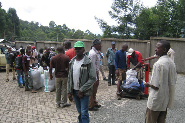
Porters weighing gear
Day 2 – Mti Mkubwa Camp (2,820 meters) to Shira Camp 1 (3,610 meters)
Distance: ~8km / 5 miles
Trekking time: 5-6 hours
Zone: Low-alpine zone
On day two you will spend the first hour trekking through the last section of rainforest path before entering the low alpine moorland zone which follows up onto the Shira Plateau. The trek is relatively short and gradual, ending at Shira Camp 1 (3,610 meters).
Day 3 – Shira Camp 1 (3,610 meters) to Shira Camp 2 (3,850 meters)
Distance: 7km / 4 miles
Trekking time: 3-4 hours
Zone: Low-alpine zone / High-alpine zone
On day three the trek crosses the Shira Plateau from Shira Camp 1 to Shira Camp 2. Nine day trekkers usually spend the night at Shira Camp 2 where they will join trekkers from the Machame Route.
At Shira Camp 2 it is worth trekking a little higher up the plateau to enjoy the stunning view across the valley below and Western Breach of Kilimanjaro above.
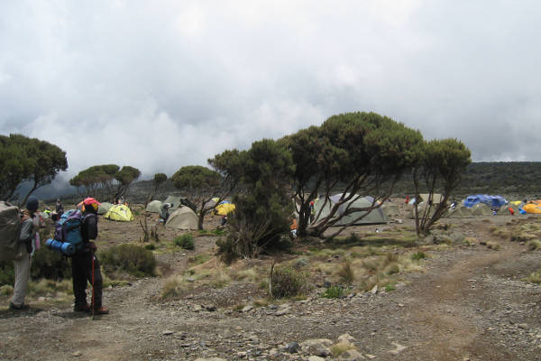
Shira Camp 2
The plateau is exposed so be prepared for a cold night with temperatures getting below zero.
My Pro Tip: Trekkers on an eight day hike will continue east up the Shira Plateau ridge and on to Lava Tower (4,600 meters) and then back down via the Northern Circuit to Moir Camp (4,200 meters).

Plan your Kilimanjaro trek
Get a quote from my recommended local Kilimanjaro operator
Day 4 – Shira Camp 2 (3,850 meters) to Lava Tower (4,600 meters) and then north to Moir Camp (4,200 meters)
Distance: 14 km / 8 miles
Trekking time: 5-7 hours
Zone: High-alpine zone
Day four is a long trek heading east which passes through the ‘Garden of the Senecios’ and then enters the high alpine desert zone.
The morning is spent trekking up to Lava Tower and the iconic Shark’s Tooth rock formation at 4,600 meters, where you will have lunch.
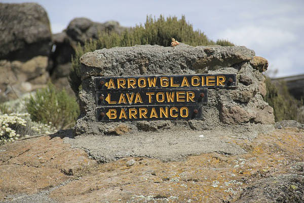
After lunch you will join the northern circuit heading down to Moir Camp at 4,200 meters (see my map above).
This is an important day in your trek as you will get to experience high altitude and then sleep low, which is good for the acclimatisation process.
Day 5 – Moir Camp (4,200 meters) to Buffalo Camp (4,020 meters)
Distance: 12 km / 7.5 miles
Trekking time: 5-7 hours
Zone: High-alpine zone
Day five involves a moderately steep climb out of Moir Valley.
Trekkers can take a small detour here to climb the summit of Little Lent Hill at 4,375 meters before returning to the Northern Circuit trail.
From here the route follows a series of inclines and declines, skirting around the northern slopes of Kibo to Buffalo Camp (4,020 meters).
The trek gives great vistas out across the plains that lie north of Kilimanjaro and stretch out to the Kenyan / Tanzanian border.
You will arrive at Buffalo Camp just after midday, where you will have lunch and have time to rest after a long day hiking.

Plan your Kilimanjaro trek
Get a quote from my recommended local Kilimanjaro operator
Day 6 – Buffalo Camp (4,020 meters) to Rongai Third Cave (3,800 meters)
Distance: 8 km / 5 miles
Trekking time: 5-7 hours
Zone: High alpine zone and low alpine zone
Day six starts with a climb up the Buffalo ridge and down into Porfu Camp where lunch is usually served. The route then continues east around the northern slopes to the Rongai Third Cave at 3,800 meters.
The trek is shorter than the day before and by now you should be feeling well acclimatised to the altitude. You will arrive at the Third Cave just around mid-afternoon.
Day 7 – 3rd Cave (3,800 meters) to School Hut (4,800 meters)
Distance: ~15km / 8.5 miles
Trekking time: 4-5 hours
Zone: High alpine zone
Day seven involves a steady incline up and over the Saddle which sits between the peaks of Kibo and Mawenzi Peak. Trekkers then continue walking south-west up to School Hut (4,800 meters).
After arriving at School Hut you will be served an early dinner and then you should get some shut-eye as you will be awoken before midnight to start your summit attempt.
My Pro Tip: Remember to prepare all your gear, including warm clothes, insulated water bottles, snacks, headlamp and camera before going to bed.

Plan your Kilimanjaro trek
Get a quote from my recommended local Kilimanjaro operator
Day 8 – School Hut (4,800 meters) to Uhuru Peak (5,895 meters) and then onto Millennium Camp (3,950 meters)
Distance: ~6km / 3.5 miles ascent and 10.5km / 6 mile descent
Trekking time: 6-8 hours ascent and then 4-6 hour descent
Zone: Glacial zone and all preceding zones
You will be awoken around 11:30 with hot tea and biscuits and will then begin the steep incline up the slopes of Kibo under the cover of darkness.
Your first check-point is Hans Meyer Cave where you will take a short break. The climb steepens as you approach Gilman’s Point (5,681 meters), which will be around 5-6 hours after departing School Hut.
Take a moment to enjoy the approaching dawn and incredible view out and across to Mawenzi Peak, but remember you still have 2 hours trekking to reach Uhuru Peak so dig deep for the energy.
The slope flattens as you head west around the crater rim and you should arrive at the summit at or just after sunrise. Your stay here will be brief so get as many pictures as you can of the incredible views and surrounding glaciers.
You will then retrace your steps back around the carter rim to Stella Point (5,739 meters) where you will turn south and head down the heavily screed slopes of Kibo to Barafu Camp (4,680 meters).
Most trekkers take a short break here before continuing down to Millennium Camp (3,950 meters) for your final night on the mountain. In total you will be trekking for 14-16 hours on day eight so it is important to pace yourself, remain hydrated and keep your blood sugar levels up.
My Pro Tip: some tour operators return via Gilman’s Point to Horombo Hut using the Marangu Route.

Plan your Kilimanjaro trek
Get a quote from my recommended local Kilimanjaro operator
Day 9 – Millennium Camp (3,950 meters) to Mweka Gate (1,640 meters)
Distance: ~10km / 6.5 miles
Trekking time: 3-4 hours
Zone: Rainforest zone
The final day is a short hike through the dense montane rainforest from Millennium Camp (3,950 meters) to Mweka Gate (1,640 meters).
At the gate you will need to sign-out with the authorities, who will also provide you with your official certificate – a green certificate for those who made it to Gilman’s Point and a gold certificate for those who reached Uhuru Peak.
It is customary to give your guides and porters tips at this point (see: tipping Kilimanjaro porters) before being driven back to your hotel in Moshi or Arusha.
Northern Circuit Kilimanjaro Route Altitude Profile
Here's what the Kilimanjaro Northern Circuit route altitude profile looks like.

My Final Thoughts
And there you have it: A quick and easy guide to the Northern Circuit. Will you take this route up Kilimanjaro? Let me know in the comments below and let's share the love.
Read more about my other Kilimanjaro routes and helpful guides:

Hi Mark. Great information. A friend and I are considering to climb Kili and we know that some people paraglide down. We are not pilots and would like to find a SERIOUS and specialised company that could takes us a “passengers” for a tandem jump. Without having to break the bank for it. Any chance you can point us in the right direction? Many thanks.
Hi Christophe, I am aware that some people have paraglided off Kilimanjaro but I don’t know any operators who offer this. I believe you have to get special permission from Kilimanjaro National Park officials.
Hi Im 64 yo female fit but normal fit and healthy.
I have done a lot of adventurous travelling and trekking including altitude climbing Ihave always thought of doing this climb.
Is it too late in regard to age in your opinion.
Hi Marg, no, it’s not too late. Many people in there 60s, and even 70s have summited Kilimanjaro. For inspiration check out this 86 year old who summited a few years ago: https://www.climbkilimanjaroguide.com/angela-vorobeva-become-the-oldest-woman-to-climb-kilimanjaro/
Hi Mark.
I’m looking at orgainizing a private climb up the Northern circuit.
I’m from Australia and am unsure what company to use..Any suggestions?
Hi Jacqui, I recommend using our quote service: https://www.climbkilimanjaroguide.com/go/
I’m interested in climbing the northern circuit route. Would there be any availability starting the 1st of August?
Hi Scot, we are not a tour operator, but you can get in touch with our recommended partner here: https://www.climbkilimanjaroguide.com/go/
Mark
Great Site.. a quick question.. Which of the longer routes would generally be considered the most scenic? We are thinking of doing the trek in Sept/Oct 2019.
Hi Yves, I would say the 8 day Lemosho is the most scenic. The Northern Circuit is also up there!
Thank you for this blog.
First, Thank you for this site – It’s awesome! We are interested in a Kili trek. It would be very helpful to see a comparison chart of the different routes in terms of: easiest to hardest, mileage/hours and altitude covered each day, most scenic vs least scenic, etc. Does this comparison exist somewhere? Which route would be the easiest and most scenic? Is one tour operator/guides better than the others?
Hi Donna, thanks for getting in touch. I’m not aware of a comparison chart of the routes on Kilimanjaro. When I get a chance I will add on to this site. In terms of the easiest route there really is not much difference across all the routes. All routes end at the same point – the summit – and none required technical skills. The Marangu has the reputation of being the easiest as it is the shortest and you stay in hut accommodation. But I think it’s label as the easiest is misleading as the route doesn’t provide much time for acclimatisation and therefore the incidence of altitude sickness is relatively high. My advice to make your hike “easier” and give yourself a higher chance of reaching the summit would be to go for one of the longer route profiles that provide more time to acclimatise. The 7 day Machame of 8 day Lemosho are my recommend choices. Both are super scenic too. Hope this helps!
Please advise a company to organize a Northern Circuit trek, private, for only my husband and me.
Hi Kelly, please use this form: https://www.climbkilimanjaroguide.com/go/
Hello,
My spouse and I are looking to reserve a trek on the Northern Circuit in late August. We are deliberating between an eight and a nine-day trek. Can you offer a recommendation of one vs. the other? It looks reasonable to do the 8-day version from what we could see of the typical itineraries, but we’re basing that judgment on most of our climbing being below 15K ft. elevation vs. the 19.4K ft at Kili summit
Hi Dave, 8-days is generally fine on the Northern Circuit, but on the whole the more time you are on the mountain before the summit push the better acclimatised you will be and the higher the chance of reaching the summit. The 9-day breaks up the trek a bit more, so you can conserve energy and provides an additional acclimatisation day. Of course, the additional time on the mountain can work against one too in terms of trekking fatigue and general malaise from not washing properly or sleeping in a tent for 8 nights. If you are super fit then go with the 8 day, if you want to play it safe, the 9 day Northern Circuit is a better shout! Good luck!
We are a groupe of 4 people and we would like to climb the northern way up to the Kili , around the end of januari 2018 (full moon on the 31th on the top!)
Can you tell us the price for this event?
W’re from Switzerland and w’re used to mountain-climbs.
Hi Elisabeth, We are not a tour operator. Please use our recommendation service here: https://www.climbkilimanjaroguide.com/go/
Does the temperature on Summit day and at summit point drop to -20 degrees celsius in February as well? What are temperatures in February generally?
Hi Tara, the temperatures can drop as low as -20 degrees Celcius if the wind chill factor is high! See here for weather information and forecasts: https://www.climbkilimanjaroguide.com/kilimanjaro-weather/
Hi
Two frien and I relatively fit 50 somethings would like to climb kili as part of our bucket list
Two of us don’t like heights
Are there points on the kili climb which are sheer drops or do we have the mountain on one side at all tomes
The only section on Kilimanjaro that has a little exposure is the Barranco Wall. Read about it here: https://www.climbkilimanjaroguide.com/barranco-wall-mt-kilimanjaro/
Is the Northern Circuit available first week of June, 2016?
Hi Gary, yes, the Northern Circuit is open all year round. I recommend getting a quote from my recommended trek operator: https://www.climbkilimanjaroguide.com/go/